(Xinhua) 08:21, December 21, 2021

Image captured by the satellite SDGSAT-1 shows a view of Paris in France. China's recently launched Earth science satellite has sent back its first remote sensing images, according to its developer, the Chinese Academy of Sciences (CAS). Using thermal infrared, low light level and multispectral imagers, the satellite captured images of multiple cities and regions, including Beijing, Shanghai, the Yangtze River Delta, Lake Namtso in Tibet, Aksu Prefecture in Xinjiang, and Paris in France. The satellite SDGSAT-1 is the world's first space science satellite dedicated to serving the U.N. 2030 Agenda for Sustainable Development. The satellite was launched into space on Nov. 5. (Chinese Academy of Sciences/Handout via Xinhua)
BEIJING, Dec. 20 (Xinhua) -- China's recently launched Earth science satellite has sent back its first remote sensing images, according to its developer, the Chinese Academy of Sciences (CAS).
Using thermal infrared, low light level and multispectral imagers, the satellite captured images of multiple cities and regions, including Beijing, Shanghai, the Yangtze River Delta, Lake Namtso in Tibet, Aksu Prefecture in Xinjiang, and Paris in France.
The satellite SDGSAT-1 is the world's first space science satellite dedicated to serving the U.N. 2030 Agenda for Sustainable Development.
It is designed to provide space observation data for the monitoring, evaluation and study of interactions between humans, nature and sustainable development, according to CAS.
The low light level imager can reflect the level of social and economic development in an area and the pattern of human settlements by detecting the intensity and distribution of night lights.
The multispectral imager can monitor the water color index and transparency of various turbid water bodies, and the multispectral data can be used to analyze changes in glaciers, melting snow and vegetation coverage.
The thermal infrared imager can survey changes in land surface and water temperatures as well urban heat energy distribution, providing basic data for crop cultivation, pest control and disease control.
The satellite was launched into space on Nov. 5.

Image captured by the satellite SDGSAT-1 shows a view of Ulan Ul Lake in northwest China's Qinghai Province. China's recently launched Earth science satellite has sent back its first remote sensing images, according to its developer, the Chinese Academy of Sciences (CAS). Using thermal infrared, low light level and multispectral imagers, the satellite captured images of multiple cities and regions, including Beijing, Shanghai, the Yangtze River Delta, Lake Namtso in Tibet, Aksu Prefecture in Xinjiang, and Paris in France. The satellite SDGSAT-1 is the world's first space science satellite dedicated to serving the U.N. 2030 Agenda for Sustainable Development. The satellite was launched into space on Nov. 5. (Chinese Academy of Sciences/Handout via Xinhua)

Image captured by the satellite SDGSAT-1 shows a view of Aksu Prefecture in northwest China's Xinjiang Uygur Autonomous Region. China's recently launched Earth science satellite has sent back its first remote sensing images, according to its developer, the Chinese Academy of Sciences (CAS). Using thermal infrared, low light level and multispectral imagers, the satellite captured images of multiple cities and regions, including Beijing, Shanghai, the Yangtze River Delta, Lake Namtso in Tibet, Aksu Prefecture in Xinjiang, and Paris in France. The satellite SDGSAT-1 is the world's first space science satellite dedicated to serving the U.N. 2030 Agenda for Sustainable Development. The satellite was launched into space on Nov. 5. (Chinese Academy of Sciences/Handout via Xinhua)

Image captured by the satellite SDGSAT-1 shows a view of Jiaozhou Bay in East China's Shandong Province. China's recently launched Earth science satellite has sent back its first remote sensing images, according to its developer, the Chinese Academy of Sciences (CAS). Using thermal infrared, low light level and multispectral imagers, the satellite captured images of multiple cities and regions, including Beijing, Shanghai, the Yangtze River Delta, Lake Namtso in Tibet, Aksu Prefecture in Xinjiang, and Paris in France. The satellite SDGSAT-1 is the world's first space science satellite dedicated to serving the U.N. 2030 Agenda for Sustainable Development. The satellite was launched into space on Nov. 5. (Chinese Academy of Sciences/Handout via Xinhua)

Image captured by the satellite SDGSAT-1 shows a view of the Yangtze River Delta. China's recently launched Earth science satellite has sent back its first remote sensing images, according to its developer, the Chinese Academy of Sciences (CAS). Using thermal infrared, low light level and multispectral imagers, the satellite captured images of multiple cities and regions, including Beijing, Shanghai, the Yangtze River Delta, Lake Namtso in Tibet, Aksu Prefecture in Xinjiang, and Paris in France. The satellite SDGSAT-1 is the world's first space science satellite dedicated to serving the U.N. 2030 Agenda for Sustainable Development. The satellite was launched into space on Nov. 5. (Chinese Academy of Sciences/Handout via Xinhua)

Image captured by the satellite SDGSAT-1 shows a view of the Yellow River estuary. China's recently launched Earth science satellite has sent back its first remote sensing images, according to its developer, the Chinese Academy of Sciences (CAS). Using thermal infrared, low light level and multispectral imagers, the satellite captured images of multiple cities and regions, including Beijing, Shanghai, the Yangtze River Delta, Lake Namtso in Tibet, Aksu Prefecture in Xinjiang, and Paris in France. The satellite SDGSAT-1 is the world's first space science satellite dedicated to serving the U.N. 2030 Agenda for Sustainable Development. The satellite was launched into space on Nov. 5. (Chinese Academy of Sciences/Handout via Xinhua)

Image captured by the satellite SDGSAT-1 shows a view of Lake Namtso in southwest China's Tibet Autonomous Region. China's recently launched Earth science satellite has sent back its first remote sensing images, according to its developer, the Chinese Academy of Sciences (CAS). Using thermal infrared, low light level and multispectral imagers, the satellite captured images of multiple cities and regions, including Beijing, Shanghai, the Yangtze River Delta, Lake Namtso in Tibet, Aksu Prefecture in Xinjiang, and Paris in France. The satellite SDGSAT-1 is the world's first space science satellite dedicated to serving the U.N. 2030 Agenda for Sustainable Development. The satellite was launched into space on Nov. 5. (Chinese Academy of Sciences/Handout via Xinhua)

Image captured by the satellite SDGSAT-1 shows a view of Aksu Prefecture in northwest China's Xinjiang Uygur Autonomous Region. China's recently launched Earth science satellite has sent back its first remote sensing images, according to its developer, the Chinese Academy of Sciences (CAS). Using thermal infrared, low light level and multispectral imagers, the satellite captured images of multiple cities and regions, including Beijing, Shanghai, the Yangtze River Delta, Lake Namtso in Tibet, Aksu Prefecture in Xinjiang, and Paris in France. The satellite SDGSAT-1 is the world's first space science satellite dedicated to serving the U.N. 2030 Agenda for Sustainable Development. The satellite was launched into space on Nov. 5. (Chinese Academy of Sciences/Handout via Xinhua)

Image captured by the satellite SDGSAT-1 shows a view of Beijing, capital of China. China's recently launched Earth science satellite has sent back its first remote sensing images, according to its developer, the Chinese Academy of Sciences (CAS). Using thermal infrared, low light level and multispectral imagers, the satellite captured images of multiple cities and regions, including Beijing, Shanghai, the Yangtze River Delta, Lake Namtso in Tibet, Aksu Prefecture in Xinjiang, and Paris in France. The satellite SDGSAT-1 is the world's first space science satellite dedicated to serving the U.N. 2030 Agenda for Sustainable Development. The satellite was launched into space on Nov. 5. (Chinese Academy of Sciences/Handout via Xinhua)

Image captured by the satellite SDGSAT-1 shows a view of east China's Shanghai. China's recently launched Earth science satellite has sent back its first remote sensing images, according to its developer, the Chinese Academy of Sciences (CAS). Using thermal infrared, low light level and multispectral imagers, the satellite captured images of multiple cities and regions, including Beijing, Shanghai, the Yangtze River Delta, Lake Namtso in Tibet, Aksu Prefecture in Xinjiang, and Paris in France. The satellite SDGSAT-1 is the world's first space science satellite dedicated to serving the U.N. 2030 Agenda for Sustainable Development. The satellite was launched into space on Nov. 5. (Chinese Academy of Sciences/Handout via Xinhua)
 Strictly star Giovanni Pernice's former partner Rose Ayling
 China's industrial profits up 4.3% in Q1
 Renowned musicians Friendship Trio wow audiences in Shanghai
 Myanmar's Chinese bookstores offer easy access to Chinese language learning materials
 ‘The Blue Angels,’ filmed for IMAX, puts viewers in the ‘box’ with the elite flying squad
What's next for Iran after death of its president in crash?
 JERUSALEM (AP) — The death of Iran’s president is unlikely to lead to any immediate changes in Iran’ ...[Detailed]
China Movie Channel relaunches premium subscription channel
 China Movie Channel announced plans to relaunch a premium subscription channel during a press confer ...[Detailed]
Nepal general advocates enhanced China
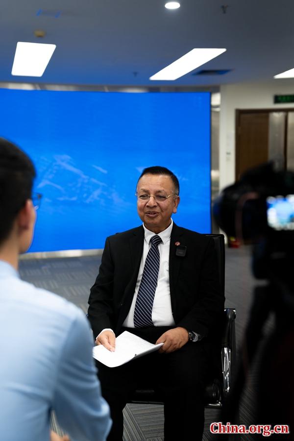 General Rajendra Chhetri, former Chief of Army Staff of Nepal, gives an interview with China.org.cn. ...[Detailed]
Wine to five! Dolly Parton 'planning to launch own range of alcoholic drinks'
Country music legend Dolly Parton is reportedly set to release her own range of wine.The singer, 78, ...[Detailed]‘The Blue Angels,’ filmed for IMAX, puts viewers in the ‘box’ with the elite flying squad
 If you’re looking for a little bit of that “ Top Gun: Maverick ” spectacle and thrill at the movie t ...[Detailed]
C.J. Sansom, bestselling British author of Tudor crime thriller series, dies at 71
 LONDON (AP) — British author C.J. Sansom, best known for his historical crime novels featuring the T ...[Detailed]
China, Cambodia to move forward in building high
 Chinese Foreign Minister Wang Yi, also a member of the Political Bureau of the Communist Party of Ch ...[Detailed]
Inside seven of Britain's best secret beaches
As the weather warms up, many Britons will be beginning to plan their staycations - looking for the ...[Detailed]Jon Wysocki dead at 53: Staind drummer passes away
The music world is in mourning this Sunday, with word that original Staind drummer Jon Wysocki passi ...[Detailed]Amy Childs threw a lavish birthday party for her twins at the Leez Priory 16th-century mansion in Es ...[Detailed]Mohammad Mokhber: Who is Iran’s acting president?

Xi, Lula send congratulatory letters to seminar involving CPC, Workers' Party of Brazil